Map and pictures of Camp Everton
"There is no such thing as inclement weather, only inappropriate clothing." — Ben Zander, Boston Philharmonic Orchestra Conductor, on Sixty Minutes.
Summer camps are being planned for 2007. All adult members are invited to be part of the leadership team. Youth members or their parents who are interested should send a note by e-mail if you would like to receive personal notification about the summer camp program.
The Cub Camp is being planned for two sessions during the weeks of July 8 to 13 and July 15 to 20, 2007. Do Your Best to be there — pencil it in your calendar now. Contact Sarah Kassa for more information about the summer Cub Camps.
The Scout Camp is being planned for the week of July 21 to 27, 2007. Be Prepared — plan ahead for summer camp. Note that date in your calendar. Contact Ted Claxton for more information about the summer Scout Camp.
The North Waterloo Camp Committee has a policy that firewood should not be brought to camp due to the possibility of transfer of local infections to the Everton Forest that might infect our Camp and the adjoining Conservation Authority woodlands and the County Agreement Forest. Firewood must not be brought to Camp Everton under any circumstances from the region of Greater Toronto or from Tri-Shores region. Firewood from those regions may be infested with Emerald Ash borers or Asian longhorn beetles.
Please review the Central Ontario Camping Rules and Procedures (62 Kb PDF) document before you go camping.
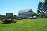
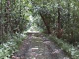
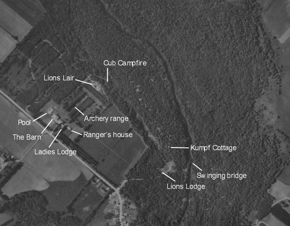
Map and pictures of Camp Everton
Here is an aerial view of Camp Everton. Here is a Google satellite view of Camp Everton.
Camp Everton is filled with breath-taking scenery, cedar and mixed bush, small limestone caves and majestic cliffs. There are large open fields, dense bush, and a swamp. The beautiful Eramosa River flows through the 185 acres comprising the Camp. The camp has two formal campfire circles and an open air chapel. The camp has numerous camping sites, a large barn with full facilities, 6 cabins of varying capacities and facilities and 11 adirondacks. The camp may be used year round for Scouting events. Scouters are welcome to drop by any weekend. Our Campmaster or Camp Ranger will be glad to assist you.
Camp Everton is about 50 minutes from K-W, just off Wellington Road 124, (formerly Hwy 24) north-east of Guelph.
Location: 7th Line of Eramosa Township — Emergency Locator Number 5286
Mailing Address: RR #4, Rockwood, Ontario, N0B 2K0
Camp Phone: (519) 856-0651
Camp Fax: (519) 856-0795
You can book Camp Everton 3 ways:
Here are text directions to Camp Everton. Here is a map to Camp Everton (8 Kb PDF).
Visit our Policies and Fees page for important information.
This is the water report for Wheeler Lodge for April 2005 — March 2006 (133 Kb PDF).
Map and pictures of Camp Mohawk
Camp Mohawk is situated beside the Grand River in Kitchener. It consist of approximately 35 acres on the Grand River near the corner of Bridge St. and Lancaster St. It is available to groups to use on a daily basis. It's facilities include:
![]() Contact the KW Scout Shop for booking the camp and picking up the key.
Contact the KW Scout Shop for booking the camp and picking up the key.
Here is a map & directions to Camp Mohawk.
Blue Springs is a provincial camping facility. It can be used year round for Scouting events. Blue Springs is about 55 minutes from K-W, just off highway 7, east of Guelph. It is 8 km south of Camp Everton.
Here is a map to Blue Springs (8 Kb PDF).
You can book Blue Springs 3 ways:
Here is a map (PDF file) of nearby camping facilities you can consider for use with your group. (With the kind permission of Scouter Liam Morland and the NW Scouters' Club)
Please visit the Government of Ontario's website for West Nile Virus information.
